The Ministry of Interior presents the EIA report and accelerates work on the Mae Wang Reservoir.
Last updated: 13 ต.ค. 2565 |

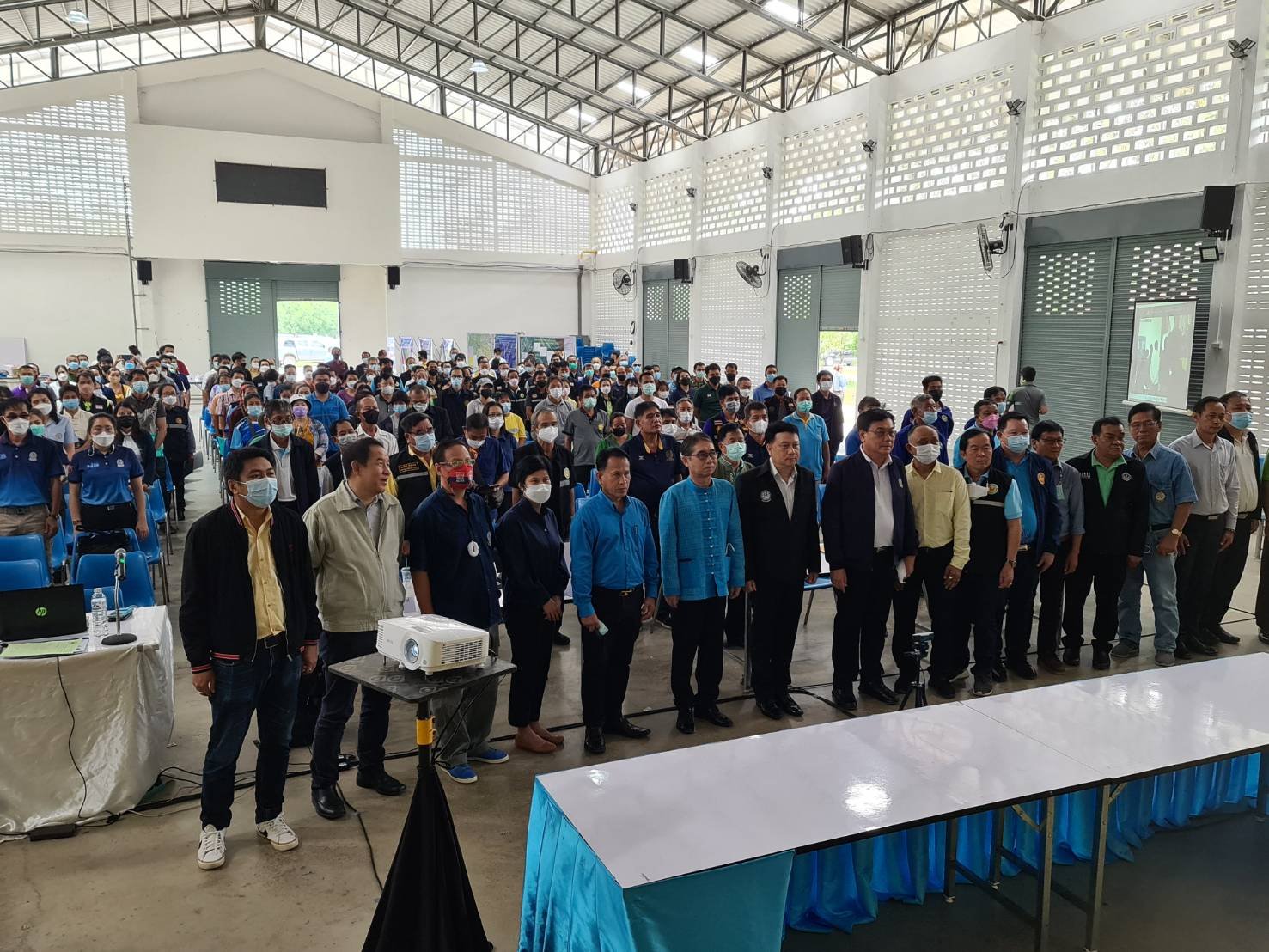
The irrigation departments of mae Wang provinces, San Pa Tong and Doi Lo, participated in the hearing on the environmental impact assessment of the Mae Wang Basin, in Chiang Mai Province.
The goal is to prevent repetitive problems with droughts and floods on both sides of the Mae Wang River from being hollowed out and eliminated. Another goal is to ensure water security in 82 villages and to provide the people in the villages with a better livelihood, as well as a better agricultural sector.
to enable.
The district relies primarily on the water from the Mae Wang River and tributaries for agricultural and consumer purposes.
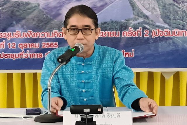
Mr. Surachart Malasri, the Director, of the Project Management Office Irrigation Department, announced that the residents in the districts of Mae Wang, San Pa Tong and Doi Lo, from a total of 82 villages with 11 subdistricts, have been suffering from drought problems and floods since 1985.
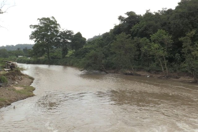
During the dry season, the water in such rivers has a lower water level. In the rainy season, the water level then swells and floods, on both sides of the Mae Wang River the farmland, causing considerable damage to the yields.
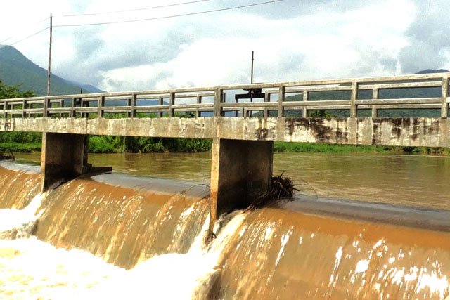
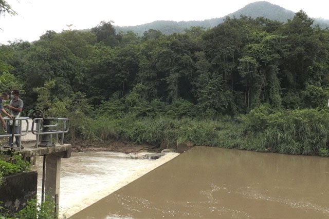
The irrigation department has therefore started a small construction project model that is very well suited to the geological conditions to eliminate the problem. By building 11 irrigation weirs along the Mae Wang River, the reservoir area can be increased by 45,500 rai.
However, farmers continue to suffer from water shortages for their fields. Water for cultivation during the dry season is available.
The irrigation department was therefore asked in a letter to build the Mae Wang Reservoir project (2004).
However, based on the preparation of a pre-feasibility study, it was determined that some of the headlands and reservoirs are located in the 1st Class Watershed Quality Zone in Mae Khan National Forest and Mae Wang National Park.
In addition, some of the headlands and reservoirs are located in Mae Wang National Park and Ob Khan National Park (preparatory), where environmental impact assessment reports must be submitted to the relevant authorities for approval before the next steps are approved.
"The Irrigation Department is the authority responsible for providing water resources in various areas, especially irrigated areas."
Therefore, it has started conducting studies and preparing suitability study reports and environmental impact assessment reports for the Mae Wang Reservoir Project, Chiang Mai Province.
The storage area of agricultural land amounted to 48,780 Rai in the 3 districts mentioned above.
It is divided into 38,209 thousand rai of rainy season irrigated land. 20,489 Rai irrigation in the dry season, which helps alleviate flooding in the Mae Wang Basin during the rainy season. It is now also a new leisure attraction in this region and it also helps to preserve and maintain the ecosystem. As well as, it adds moisture to the surrounding forest areas, especially the downstream areas of the Mae Wang Basin.
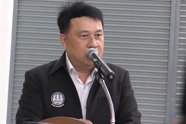
Following a public hearing on the project today (12 October), the Irrigation Department will update its comments on a full report submitted to the Office of Natural Resources Policy and Planning. Before entering the process of review, the Expert Committee will consider the Environmental Impact Report (NCPO) as the next priority".
Mr. Surachart, the director of the office, said, "In the past, meetings have been held with the farmers' groups to hear their opinions, to hear their proposals and then to implement them after extensive consideration.
It is also intended to ensure that the project or future projects meet the requirements of the development and provision of costly water resources in order to further and higher reduce costs due to damage or consequential damage."
#Thainewsasia ch.
#Guido Jellessen / Thai News Asia news team reports
.....................................................................................
กรมชลประทานลงพื้นที่รับฟังความเห็นชาวแม่วาง สันป่าตอง ดอยหล่อ เร่งศึกษาประเมินผลกระทบสิ่งแวดล้อมอ่างฯแม่วาง จ.เชียงใหม่ ตั้งเป้าแก้ปัญหาแล้งซ้ำซากให้ราษฎรสองฝั่งลำน้ำแม่วาง สร้างความมั่นคงด้านน้ำเพื่อชีวิตความเป็นอยู่ดีขึ้นให้ราษฎร 82 หมู่บ้าน
นายสุรชาติ มาลาศรี ผู้อำนวยการสำนักบริหารโครงการ กรมชลประทาน เปิดเผยว่า ราษฎรที่อาศัยในเขตอำเภอแม่วาง อ.สันป่าตอง และ อ.ดอยหล่อ จ.เชียงใหม่ รวม 11 ตำบล 82 หมู่บ้าน ประสบปัญหาภัยแล้งน้ำท่วมมายาวนาน ตั้งแต่ปี 2528 ทั้งนี้ราษฎรทั้ง 3 อำเภออาศัยน้ำจากลำน้ำแม่วางและลำห้วยสาขาเป็นหลักเพื่อใช้การทำเกษตรและอุปโภคบริโภค ในช่วงฤดูแล้งน้ำในลำน้ำดังกล่าวมีปริมาณน้อย ไม่เพียงพอต่อความต้องการใช้น้ำ ด้านพื้นที่การเกษตรก็ขาดแคลนน้ำ ผลผลิตได้รับความเสียหาย และช่วงฤดูฝนน้ำในลำน้ำแม่วางไหลบ่าเข้าท่วมพื้นที่เกษตรสองฝั่งลำน้ำ กรมชลประทานจึงได้ใช้รูปแบบโครงการก่อสร้างขนาดเล็กที่เหมาะสมกับสภาพทางธรณีวิทยาเพื่อแก้ไขปัญหา
โดยการสร้างฝายทดน้ำตลอดลำน้ำแม่วางจำนวน 11 แห่ง สามารถเพิ่มพื้นที่รับประโยชน์ได้ 45,500 ไร่ อย่างไรก็ดีเกษตรกรและราษฎรยังคงเดือดร้อนขาดแคลนน้ำเพื่อการอุปโภคบริโภค น้ำเพื่อการเพาะปลูกในช่วงฤดูแล้งอยู่ จึงได้ทำหนังสือขอให้กรมชลประทานสร้างโครงการอ่างเก็บน้ำแม่วาง ในปี 2547 และจากการจัดทำรายงานเพื่อวางโครงการ (Pre-feasibility Study) พบว่าพื้นที่หัวงานและอ่างเก็บน้ำมีพื้นที่บางส่วนอยู่ในเขตพื้นที่ชั้นคุณภาพลุ่มน้ำชั้น 1 อยู่ในเขตพื้นที่ป่าสงวนแห่งชาติป่าแม่ขานและป่าแม่วาง นอกจากนี้ พื้นที่หัวงานและอ่างเก็บน้ำบางส่วนอยู่ในอุทยานแห่งชาติแม่วาง และอุทยานแห่งชาติออบขาน (เตรียมการ) ซึ่งต้องนำเสนอรายงานการประเมินผลกระทบสิ่งแวดล้อมต่อหน่วยงานที่เกี่ยวข้องเพื่อให้ความเห็นชอบก่อนอนุญาตตามขั้นตอนต่อไป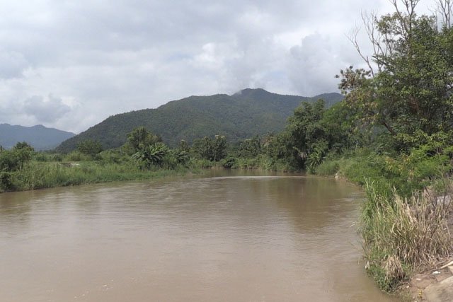
“กรมชลประทานเป็นหน่วยงานที่รับผิดชอบด้านการจัดหาแหล่งน้ำให้แก่พื้นที่ต่าง ๆ โดยเฉพาะพื้นที่ชลประทาน จึงได้เริ่มดำเนินการศึกษาและจัดทำรายงานการศึกษาความเหมาะสม และรายงานการประเมินผลกระทบสิ่งแวดล้อม ‘โครงการอ่างเก็บน้ำแม่วาง จังหวัดเชียงใหม่’ เมื่อกลางปี 2563 โดยที่ตั้งหัวงานอยู่บริเวณหมู่ 1 บ้านใหม่ปางเติม ต.บ้านกาด อ.แม่วาง กักเก็บน้ำต้นทุนเพิ่มได้ 25.42 ล้านลบ.ม เสริมสร้างความมั่นคงน้ำอุปโภคบริโภค ส่งน้ำให้พื้นที่เกษตรได้รวม 48,780 ไร่ใน 3 อำเภอดังกล่าวข้างต้น แบ่งเป็นพื้นที่ชลประทานฤดูฝน 38,209 หมื่นไร่ ชลประทานฤดูแล้ง 20,489 ไร่ ช่วยบรรเทาอุทกภัยลุ่มน้ำแม่วางช่วงหน้าฝน เป็นแหล่งท่องเที่ยวพักผ่อนหย่อนใจแห่งใหม่ในพื้นที่ อ.แม่วาง จ.เชียงใหม่ และยังช่วยรักษาระบบนิเวศน์ เพิ่มความชุ่มชื้นให้แก่พื้นที่ป่าไม้บริเวณโดยรอบ
โดยเฉพาะพื้นที่ท้ายน้ำของลุ่มน้ำแม่วาง
ซึ่งภายหลังจากรับฟังความคิดเห็นของประชาชนในการปัจฉิมนิเทศโครงการในวันนี้ (12 ต.ค.) กรมชลประทานจะนำความคิดเห็นของราษฎรมาปรับปรุงเป็นรายงานฉบับสมบูรณ์นำเสนอต่อสำนักงานนโยบายและแผนทรัพยากรธรรมชาติ ก่อนเข้าสู่กระบวนการพิจารณาของทางคณะกรรมการผู้ชำนาญการพิจารณารายงานผลกระทบสิ่งแวดล้อม (คชก.) เป็นลำดับถัดไป” นายสุรชาติ กล่าว
“อย่างไรก็ดีที่ผ่านมามีการลงพื้นที่เพื่อประชุมรับฟังความคิดเห็นจากกลุ่มราษฎร กลุ่มเกษตรกร กลุ่มประกอบการล่องแพไม้ไผ่ ที่ได้รับผลกระทบอย่างสม่ำเสมอ ทั้งนี้เพื่อให้การดำเนินโครงการสนองต่อการพัฒนาและจัดหาแหล่งน้ำต้นทุนในการแก้ไขปัญหาการขาดแคลนน้ำในระยะยาว ทั้งเพื่อการชลประทาน อุปโภคบริโภค พัฒนาการเกษตร การท่องเที่ยวทั้งในปัจจุบันและความต้องการในอนาคตได้อย่างยั่งยืนที่สุด” ผู้อำนวยการสำนัก ฯ กล่าวตอนท้าย.
#Thainewsasia ch.
เนื้อหาที่เกี่ยวข้อง


